mne.viz.iter_topography#
- mne.viz.iter_topography(info, layout=None, on_pick=None, fig=None, fig_facecolor='k', axis_facecolor='k', axis_spinecolor='k', layout_scale=None, legend=False)[source]#
Create iterator over channel positions.
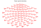
This function returns a generator that unpacks into a series of matplotlib axis objects and data / channel indices, both corresponding to the sensor positions of the related layout passed or inferred from the channel info. Hence, this enables convenient topography plot customization.
- Parameters:
- info
mne.Info The
mne.Infoobject with information about the sensors and methods of measurement.- layoutinstance of
mne.channels.Layout|None The layout to use. If None, layout will be guessed.
- on_pick
callable()|None The callback function to be invoked on clicking one of the axes. Is supposed to instantiate the following API:
function(axis, channel_index).- fig
matplotlib.figure.Figure|None The figure object to be considered. If None, a new figure will be created.
- fig_facecolorcolor
The figure face color. Defaults to black.
- axis_facecolorcolor
The axis face color. Defaults to black.
- axis_spinecolorcolor
The axis spine color. Defaults to black. In other words, the color of the axis’ edge lines.
- layout_scale
float|None Scaling factor for adjusting the relative size of the layout on the canvas. If None, nothing will be scaled.
- legendbool
If True, an additional axis is created in the bottom right corner that can be used to, e.g., construct a legend. The index of this axis will be -1.
- info
- Returns:
- gengenerator
A generator that can be unpacked into:
- axmatplotlib.axis.Axis
The current axis of the topo plot.
- ch_dxint
The related channel index.
